Imagine getting on a bus and going for a ride on the highway—with no driver. Or imagine having your car tell you that you’re about to hit a traffic snarl and suggest an alternate route. Pretty cool, right? These applications are possible only with advanced digital signal processing—not only inside the vehicle, but outside as well.
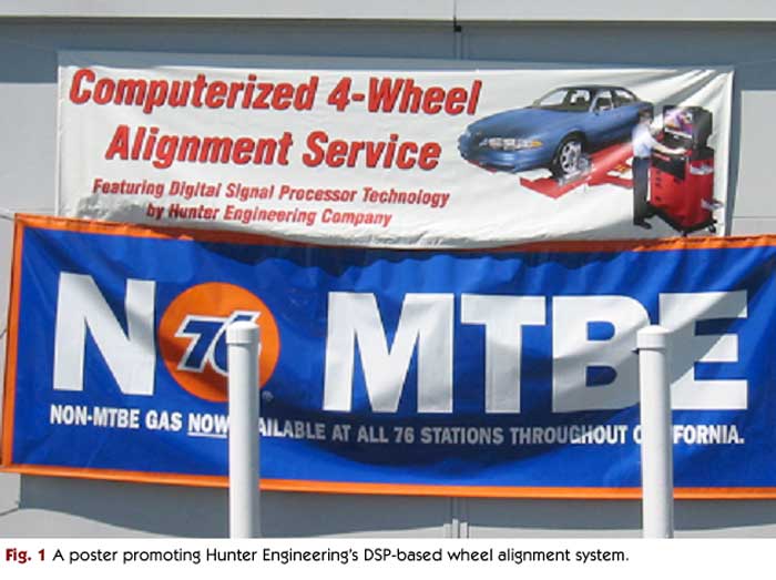
Digital signal processing is already used outside of the car in automotive-related application areas ranging from traffic control to road maintenance. Radar speed detectors, for example, use signal-processing techniques to measure the Doppler shift of reflected signals. Signal processing is also used to measure the structural integrity of bridges through probing and analysis of the structure. And, as Figure 1 shows, automotive repair shops even highlight the “digital signal processor technology” used in some wheel-alignment equipment!
In this article, we present an overview of two key categories of outside-the-car signal processing: intelligent transportation systems and applications based on vehicle location systems.
Intelligent Transportation Systems
Intelligent transportation systems (ITS) are comprised of technologies used in vehicles and roadways to manage and improve traffic flow. A key component of ITS lies in traffic control systems, where signal processing plays a significant role. Signal processing-based systems are used to detect cars as they approach an intersection, thus allowing the traffic control system to change the state of the traffic light as needed.
One of the most common implementations of car detection uses an inductive loop embedded under the road surface. When a car passes overhead, the car’s metallic content alters the loop inductance, and the car is detected. Other methods of car detection include radar, laser, and air-filled tubes laid out onto the road surface. These methods employ varying degrees of signal processing and analysis in order to accurately detect vehicles.
Inductive loop detectors can also form the heart of a photo-enforced traffic light. By using information from two loops that are embedded in the roadway in front of a traffic light, the system can determine when a car has passed over the loops in quick succession—which indicates that the car is not stopping. If the light is red when the car passes, the system can trigger a high-resolution digital camera to take a photo of the offending vehicle.
Researchers and transit authorities have proposed many other uses for vehicle detection technologies. For example, by placing inductive detectors at regular intervals on highways, the current travel time between points on the highway can be computed. This type of information can be distributed to drivers (for example, through the Radio Data System used in Europe or through a telephone hotline) to help reduce congestion. Recently, such traffic information has been integrated into select vehicle navigation systems in the U.S. through Sirius and XM Satellite Radio broadcasts. These systems can show traffic congestion on a map and suggest alternate routes to drivers.
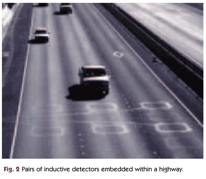
In order for inductive loops to detect traffic congestion, they must be able to detect individual cars as they traverse a stretch of highway. In other words, if the same car can be identified (with high probability) as it passes over each detector, the travel time between points can be computed. Figure 2 shows an example of embedded inductive loops used to detect congestion on a highway. One proposed way to identify individual cars is to more accurately measure the change in inductance as a car passes. Cars have different shapes, lengths, and metallic content, so each car generates a unique signature. If the same inductive signature is detected by two successive loops and the elapsed time is reasonable, it is probably the same car.
In some applications, it is necessary to determine not just that a car is present, but which car it is. For example, this capability is required for automatic toll-collecting systems such as the FasTrak, E-Zpass, and SunPass systems used in the U.S. These systems can help to reduce traffic congestion and can delay the need for lane expansion in congested areas. Nearly all of these systems use vehicle-mounted radio frequency identification (RFID) transponders that uniquely identify each car. As the car passes through the automatic toll gate, it is detected (often by a beam of light that is broken as the car passes) and a directional RF signal is sent to the transponder inside the vehicle cabin. The transponder then transmits its customer information to the toll gate, which deducts a fee from the customer’s account.
RFID tags can also be used to gather traffic information. By placing RFID transponders along a highway, transit authorities can track the speed and position of individual vehicles—thus enabling the system to determine current travel times between points on the highway. This method of tracking is simpler than trying to identify cars based on their inductive loop signature.
The combination of signal processing techniques and artificial intelligence will enable new kinds of intelligent transportation systems in the future. For example, vehicles can be automatically guided along roads by embedding magnetic markers within roads. In 1997, the California PATH research program demonstrated this technology on a short section of freeway in San Diego, where embedded magnetic markers were used to guide a “platoon” of eight automated passenger cars. This technology has since been deployed to help guide snowplows along treacherous mountain roads. Other vehicle guidance systems use GPS and machine vision to help implement road maintenance services and driverless vehicles.
The Automated Bus Rapid Transit (A-BRT) project, part of the PATH program, has demonstrated an automated passenger bus that is capable of staying within its lane on the highway, automatically changing lanes when directed by an operator, and “docking” at a bus stop with an accuracy of a few inches. This type of system requires real-time processing of data from multiple sources, including sensors, cameras, and other input devices.
Other intelligent transportation systems, either in development or deployed today, include real-time bus schedule information displayed at bus stops, public transit systems that adjust their operations according to passenger load, and automated trains that shuttle passengers within airports.
Vehicle Location Systems
Signal processing is at the heart of all vehicle location technologies. For example, GPS uses signal processing to compute the distance between the receiver and multiple geostationary satellites in order to accurately determine location.
Insurance companies are now experimenting with vehicle location technologies to reward drivers who stay within a certain area, or always comply with posted speed limits. This technology is also of use to car rental companies, who can make sure renters are driving safely, and perhaps give discounts to safe drivers. Rental companies can also use this technology to track vehicle inventory and usage. Vehicle location technologies also serve the trucking and shipping industry by improving driver efficiency and enabling accurate cargo tracking.
Some automakers are using vehicle location technologies to improve safety. For example, GM’s OnStar system alerts an operator if the airbag is deployed. The system also provides the location of the vehicle, enabling the operator to send emergency vehicles directly to the site of the accident. OnStar and similar systems enable a variety of other services. For example, OnStar offers remote diagnostics services that allow the car’s performance and status to be reported to the manufacturer. Remote diagnostics benefit drivers because some problems can be detected and diagnosed before they become serious. It also benefits the manufacturer, which can perform mass data collection and predict, for example, initial quality problems in a new model.
Vehicle location technologies can be used to track stolen vehicles, whether by GPS or other means. One popular stolen-vehicle tracking system is LoJack, which places a small transmitter in a random location within a car. LoJack trackers are placed in U.S. police cars to track and locate stolen vehicles.
Looking Forward
Digital signal processing is already revolutionizing many aspects of transportation. It is making vehicles easier to maintain and harder to steal. It is helping governments to understand their roadways better, and to keep traffic running smoothly. And it is helping trucking companies, rental companies, and insurance agencies keep costs down. It is exciting to imagine how signal processing will change the way we use our cars and roadways in the future.
Add new comment